A WINTER STORM WARNING FOR HEAVY SNOW AND BLOWING SNOW REMAINS IN EFFECT UNTIL NOON PST THURSDAY.
* SNOW WILL INCREASE OVER THE SIERRA THIS MORNING WITH PERIODS OF HEAVY SNOW THROUGH THURSDAY MORNING.
* TOTAL SNOW ACCUMULATIONS OF 12 TO 20 INCHES OF SNOW IS EXPECTED AT LAKE LEVEL…WITH 20 TO 40 INCHES ABOVE 7000 FEET.
* SOUTHWEST WINDS OF 15 TO 30 MPH WITH GUSTS OF UP TO 50 MPH TONIGHT AND THURSDAY WILL CREATE AREAS OF BLOWING AND DRIFTING SNOW. RIDGE GUSTS OF UP TO 140 MPH ARE POSSIBLE.
* RAD DOGS SHOULD EXPECT EXTREME HUCKING AND STRAIGHT RUNNING CONDITIONS AT LOCAL SKI AREAS THURSDAY AND FRIDAY. NEW SNOW TOTALS SHOULD MAKE TURNS UNNECESSARY. SKIING WITH A BEACON AND A BUDDY ARE RECOMMENDED TO AVOID POTENTIAL FATALITIES FROM SNOW SUFFOCATION. APRES SKI SHOTS AND BEERS ARE STRONGLY ENCOURAGED TO CALM NERVES AFTER ROWDY DISPLAYS OF SICKNESS AND VORACIOUS PURSUITS OF GNAR POINTS.
* CONDITIONS COULD TURN TO RAIN BY THE WEEKEND SO GET IT WHILE IT’S HOT.
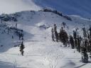 I was lucky enough to get on the reverse traverse just as it opened yesterday. The masses seemed to head elsewhere so I had the slot all to myself. Fresh, thigh-deep tracks all the way down!
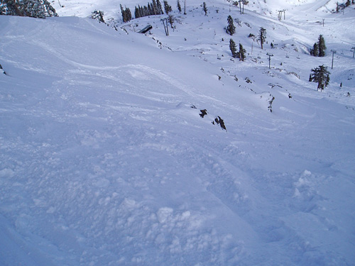

Recent Comments